
Top Mount Rainier Hikes: Family-Friendly, Short, and Full-Day Adventures
- Aug 26, 2025
- 7 min read
Updated: Sep 7, 2025
Looking for the best hikes in Mount Rainier National Park? From easy family-friendly hikes around alpine lakes to challenging day hikes with glacier views, this guide covers the top trails for every skill level. Whether you want a short walk to a waterfall, a wildflower-filled meadow loop, or a strenuous trek to Camp Muir, these Mount Rainier hikes highlight the park’s most stunning scenery. Each trail includes mileage, difficulty, and a direct link to NPS trail conditions so you can plan your adventure with confidence.

👨👩👧 Family-Friendly Hikes with Kids
Tipsoo Lake Loop (0.7 mi, ~19 ft gain)
A short, scenic stroll around Tipsoo Lake with alpine meadows and incredible wildflower displays in early summer. Expect sweeping views of Mount Rainier. Easy and ideal for families needing a quick, beautiful break. Dogs are not permitted in the immediate Lake loop.
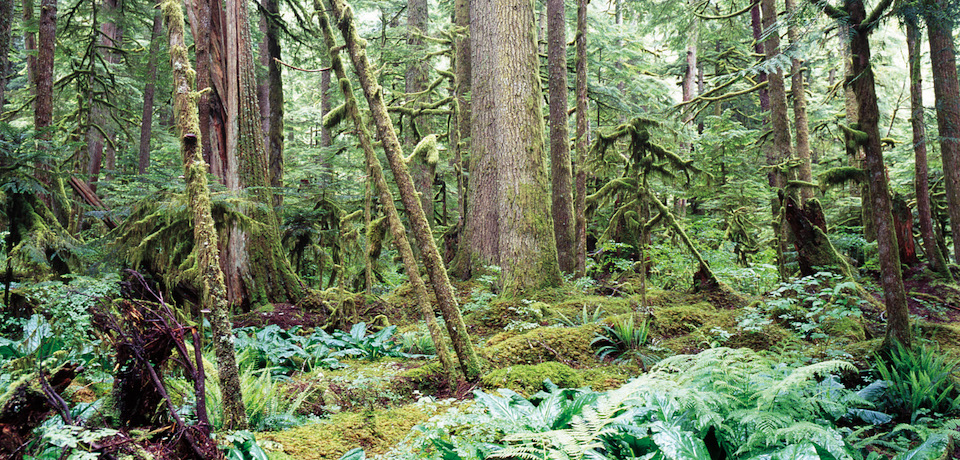
Trail of the Shadows (~1 mi round-trip)
Located in the Longmire area, this gentle walk loops through forest and meadows, passing bubbling mineral springs and a replica historic homestead. A true beginner hike with parking right across from the National Park Inn.
Sunrise Nature Trail (1.5 mi, ~370 ft gain)
A paved, self-guided alpine loop starting at the Sunrise Visitor Center. Full of wildflowers, great views of Rainier, and opportunities to spot wildlife like mountain goats. Perfect for sunrise-watching with the kids.
Naches Peak Loop (3.5 mi round-trip, ~369 ft gain)
Beginning at Tipsoo Lake, this easy loop showcases lush wildflower meadows, lake reflections, and panoramic views of the mountain. It’s outside the park boundary in sections, making it accessible without entrance restrictions—but note dogs are not allowed on the portion within the National Park or near the lake.
Silver Falls (Out-and-Back Access) (~1.5 mi one-way)
Also in the Ohanapecosh area, this trail lets you hike to Silver Falls along the Eastside Trail; it’s no longer a loop due to campground construction. You can still enjoy the forest walk and waterfall views, but you’ll return the same way.
🚶 Under 5 Miles
Myrtle Falls via Skyline Trail – 1 mile RT – Iconic photo spot in Paradise
Short, paved path from Paradise to a 60-foot waterfall with Mount Rainier in the backdrop. A few stairs and mild incline. Best in summer for wildflowers and clear views.
Bench & Snow Lakes – 2.5 miles RT – Peaceful alpine lakes
Starts with a gradual climb to Bench Lake, then continues to Snow Lake tucked beneath the Tatoosh Range. Expect meadows, huckleberries in late summer, and mountain reflections.
Fremont Lookout – 4.5 miles RT – Fire lookout with epic views
Begins at Sunrise and crosses wildflower meadows before turning rocky near the summit. The historic lookout offers sweeping views of Rainier and surrounding peaks—amazing at sunrise or sunset.
Naches Peak Loop – 3.5 miles RT – Meadows, lakes, and vistas
Loop trail circling Naches Peak, passing lakes, wildflowers, and mountain views in all directions. Start at Tipsoo Lake for the most scenic route.
Trail of the Shadows – 1 mile loop – Easy forest walk
Flat, shady loop near Longmire with bubbling mineral springs and historic homestead replica. Quick and family-friendly, great for stretching legs between stops.
Pinnacle Peak Trail – 2.5 miles RT - Moderate
This short but moderately steep trail climbs steadily from Reflection Lakes up into the Tatoosh Range. At the saddle, hikers are rewarded with sweeping views of Mount Rainier and surrounding jagged peaks. In summer, wildflowers line the switchbacks, and on clear days you can see Mount Adams and Mount St. Helens in the distance.

🥾 5–10 Miles
Skyline Trail to Panorama Point – 5.5 miles RT – Panoramic Rainier views
Starting in Paradise, this trail climbs steadily through wildflower meadows to one of the best viewpoints in the park. From Panorama Point, you can see the Nisqually Glacier, the Tatoosh Range, and even Mount Adams on clear days. In early summer, expect lingering snow; by late summer, the meadows are a sea of blooms.

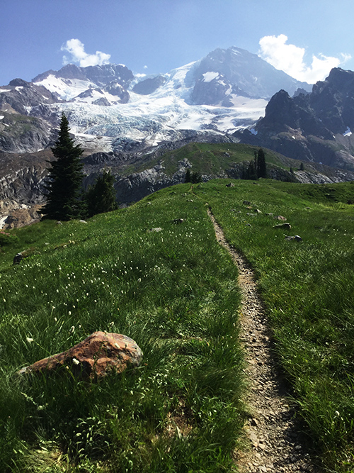
Glacier Basin Trail – 8.1 miles RT – Alpine valley & glacier views
Once the site of historic mining attempts, this trail now offers a peaceful climb along the White River through forest and meadows. About a mile in, a short spur leads to the Emmons Moraine viewpoint, where you can see the largest glacier in the lower 48.
Tolmie Peak Lookout – 5.6 miles RT – Lake & lookout panorama
From Mowich Lake, the trail winds through meadows and forest before reaching Eunice Lake—a perfect rest spot. The final push climbs to Tolmie Peak Lookout, where sweeping views of Mount Rainier and the deep blue lake below make for a picture-perfect finish.
Summerland – 8.4 miles RT – Meadows & mountain scenery
One of Rainier’s classic day hikes, Summerland takes you along Fryingpan Creek and up through lush forest to high meadows. In mid-to-late summer, the wildflowers here are spectacular, and clear days reveal glacier-covered peaks.
Burroughs Mountain (First & Second) – 8.8 miles RT – High ridge with glacier views
This Sunrise-area trail follows an open ridge with dramatic, close-up views of Rainier’s massive glaciers. The alpine tundra landscape feels otherworldly, and marmots often lounge right by the trail.
🏔 10+ Miles
Wonderland Trail Section: Longmire to Indian Henry’s Hunting Ground – 12 miles RT – Meadows & waterfalls
This scenic stretch of the Wonderland Trail takes you through old-growth forest, past waterfalls, and into the wildflower meadows of Indian Henry’s Hunting Ground. On clear days, the views of Mount Rainier are stunning.
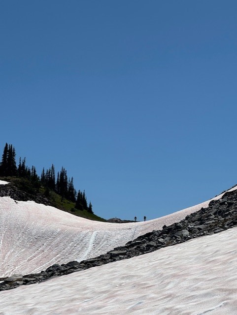
Camp Muir – 10 miles RT – High-altitude snowfield climb
Starting from Paradise via the Skyline Trail, this route leads to Rainier’s primary climber’s base camp at 10,188 feet. The trail includes a long snowfield crossing and steady elevation gain.
Knapsack Pass via Spray Park Trail – 8.5 miles RT – Meadows & rugged views
From Mowich Lake, this route climbs through forest to Spray Park’s famous meadows, then continues to Knapsack Pass for panoramic views of Rainier and the surrounding peaks.
Carbon Glacier via Wonderland Trail – 17.5 miles RT – Massive low-elevation glacier
One of the lowest glaciers in the contiguous U.S., Carbon Glacier impresses with its scale and rugged surroundings. The hike follows the Carbon River Trail—a former road open to bikes for the first section—before becoming more challenging.
Summerland to Panhandle Gap – 11 miles RT – High alpine pass with snowfields
Following the Wonderland Trail from Fryingpan Creek, this hike climbs through forest and meadows to Summerland, then continues to the highest maintained trail in the park at Panhandle Gap.
Here is the conditions of the all hikes
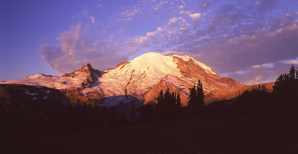
With over 260 miles of trails, Mount Rainier hiking offers something for everyone — from toddlers taking their first forest stroll to seasoned hikers chasing alpine summits. These recommended trails showcase the park’s waterfalls, wildflowers, glaciers, and sweeping mountain views in every season. Before heading out, always check the official Mount Rainier trail conditions and bring the right gear for changing weather. Use this list as your go-to guide for planning the best hikes in Mount Rainier National Park.
FAQs About Hiking Mount Rainier
How was Mount Rainier formed?
Mount Rainier is actually an active stratovolcano that started forming about half a million years ago. Layers of lava, ash, and ice built it up into the giant peak we see today.
Will Mount Rainier erupt?
Yep, eventually — it’s still considered active. Scientists keep a super close eye on it, but don’t worry, there’s no eruption expected anytime soon.
Can a beginner hike Mount Rainier?
For sure! You don’t have to summit the mountain to enjoy it. There are plenty of short, easy trails around Paradise, Sunrise, and Ohanapecosh that are perfect for beginners.
What is the most popular route on Mount Rainier?
For hikers, the Skyline Trail at Paradise is the big favorite. For climbers aiming for the summit, most go via the Disappointment Cleaver Route.
Can people climb Mount Rainier?
Yep — but it’s no joke. Climbing to the summit requires glacier travel, ropes, and mountaineering skills. Most folks go with a guide service.
What is the success rate of climbing Mount Rainier?
On average, about 50% of climbers make it to the top. Weather, altitude, and conditions turn a lot of people around.

Is a day trip to Mount Rainier worth it?
Absolutely. Even if you only have a day, you can see waterfalls, wildflowers, and epic viewpoints without a long hike. Paradise and Sunrise are the easiest spots for quick adventures.
How can you get an amazing view of Mount Rainier without hiking?
If you’re in Seattle or Tacoma, you’ll spot Rainier on clear days right from the city. Kerry Park in Seattle is a classic viewpoint, and Point Defiance in Tacoma is another easy win.
Can you recommend an easy hike with a view of Mount Rainier?
Definitely! Myrtle Falls (Paradise) is just a short paved walk with an epic Rainier backdrop. Tipsoo Lake is another family-friendly gem with reflections of the mountain.
What safety precautions should solo hikers take on Mount Rainier?
Stick to well-traveled trails, tell someone your plans, bring the 10 essentials (map, water, layers, snacks, etc.), and watch the weather — it changes fast.
How far is Mount Rainier from Seattle? Can you hike there?
It’s about a 2-hour drive from Seattle to the park entrances. You can’t just hike to Rainier from the city, but once you’re there, trails are everywhere.
Is Mount Rainier a recommended destination for visitors?
100%. It’s one of the most beautiful spots in Washington. If you have extra time, nearby hikes like Rattlesnake Ledge, Mount Si, or Snoqualmie Falls are also really popular near Seattle.
Can you hike Mount Rainier in winter?
Yep — but it’s a totally different experience. Many summer trails are snow-covered, so winter activities usually mean snowshoeing or skiing around Paradise. Always check conditions first.
Do you need a permit to hike Mount Rainier?
For most day hikes, nope. But if you’re camping overnight in the backcountry or climbing above 10,000 feet, you’ll need permits.
When is the best time to hike Mount Rainier?
July through September is prime time — that’s when the wildflowers bloom and the trails are mostly snow-free.


Comments